
This time we will talk about the importance of knowing and quantifying the terrestrial morphology and its dimensions.
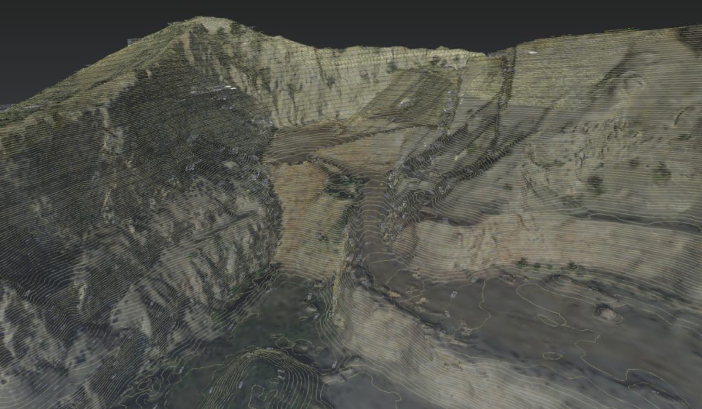
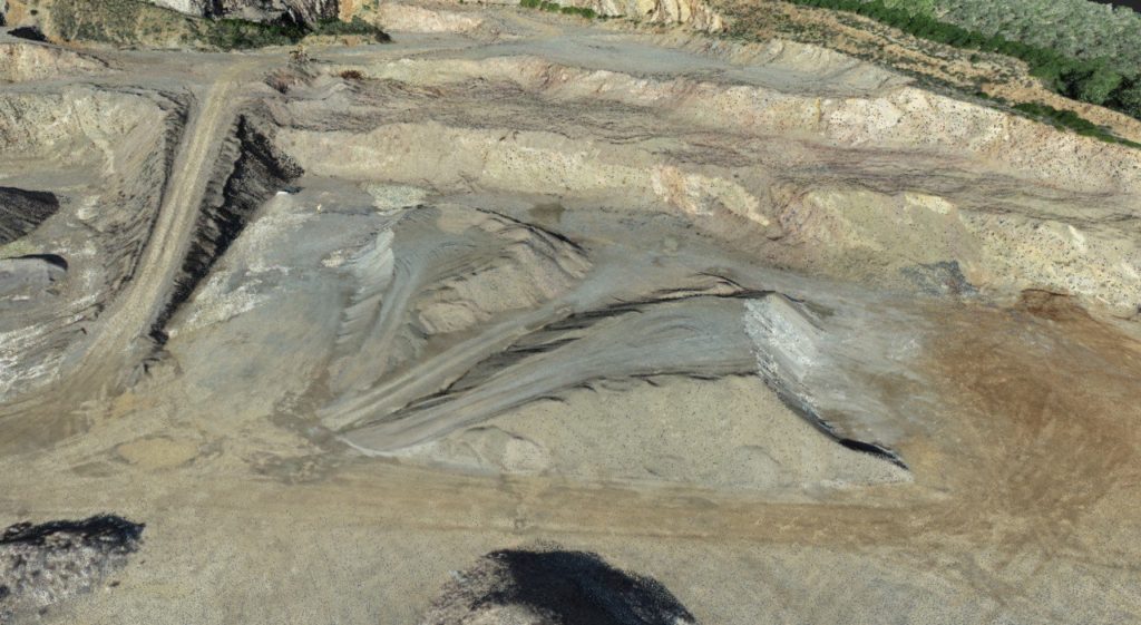
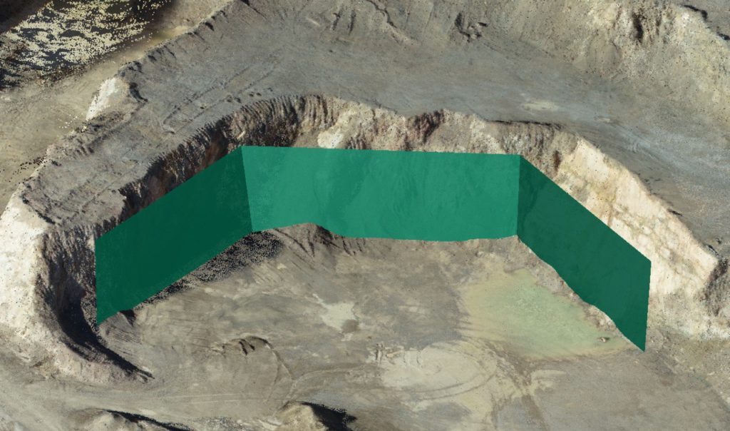
There are situations or scenarios where the complexity and irregularity of the terrain, as in excavations, slopes or quarries, requires the choice of a suitable methodology capable of capturing and analyzing such environments obtaining the most detail and precision possible.
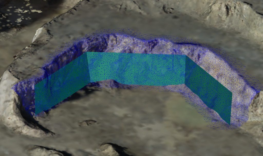
Under these conditions, the most complete and resolving option is to obtain a 3D point cloud. This data can come from a Laser Scanner or a Drone, depending on the accuracy, resolution and detail required.
This solution provides us with an infinite number of options when analysing and assessing an environment, allowing us to obtain triangulations or high quality 3D mesh or the calculation and quantification of surfaces. From these entities you can obtain sections or curves of high definition of the various elements.
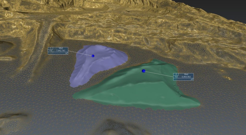
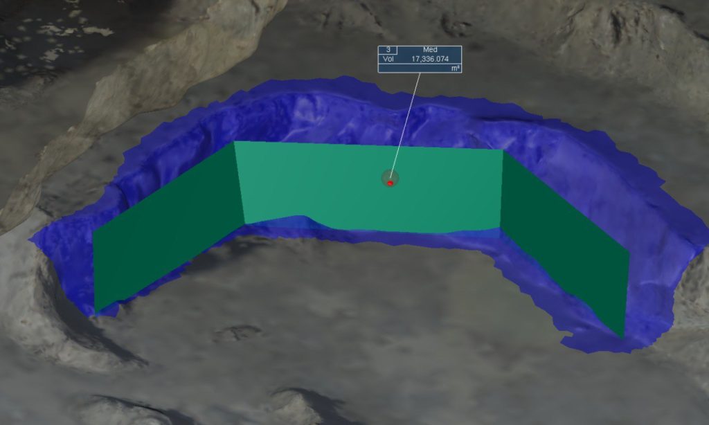
Other popular options include quantification of embankment and clearing volumes or, for the more daring, the 3D comparison by projecting 3D models or surfaces to obtain the volume contained between different elements or terrains. This option is indispensable when monitoring and controlling excavations and gunning, moving large quantities of earth or even projecting 3D models of future structures on the existing terrain;
To emphasize finally, the important task of the 3D auscultations aimed at detecting possible movements or deviations in unstable or sensitive areas. Technique that allows the comparison between several 3D point clouds, proceeding to their comparison and obtaining as a result a colored point cloud depending on the deviation or distortion obtained. This allows not only to quantify the deviation in certain specific areas, but also throughout the entire entity to be analyzed;