SURVEYING COMPANY SPECIALIZED IN 3D TECHNOLOGY
With over 10 years of experience working with professionals and individuals, we deliver practical solutions whilst offering value for money. Based in Palma de Mallorca, we provide services in the Balearic Islands and the mainland. Get in touch below!
Specialist in 3D Surveying Technology
GUARANTEES FROM
3D Survey
- We are at the forefront of surveying equipment and software
- Young and dynamic team
- Personalized and immediate attention
- Highly qualified technicians in continuous training
- Professionalism and dedication
- Our goal is to accompany you in all the stages of your project
- Guarantee of success
Our services
WHAT CAN WE DO FOR YOU?
We are a surveying company specializing in 3D technology, including Point Clouds, Laser Scanning, Drone mapping, Scan to BIM, 3D Modeling, CAD Drawings, Cadastre administration and Property law, Civil and Constructions Works, and Topographycal Surveys. Do you want to know more about 3D Survey?

WE HELP TO MAKE YOUR PROJECT A REALITY
WE SUPPORT YOU, are you an architecture firm looking for a partnership company helping you with surveying solutions? Are you an individual with a personal project? We’re here to deliver outstanding services.
WHAT OUR CLIENTS SAY ABOUT 3D SURVEY
Palma, Illes Balears 07013
651 55 37 89
-
Equipo dinámico y muy profesional. Hemos tenido la suerte de colaborar con ellos en sus proyectos d... Leer másEquipo dinámico y muy profesional. Hemos tenido la suerte de colaborar con ellos en sus proyectos de Topografía, les hemos ayudado a crear contenido y vídeos corporativos. Sin duda una empresa profesional y con ganas de darse a conocer. Leer menos
-
Hemos trabajado con ellos innumerables veces. De los mejores profesionales que hay en la isla.
-
Grandes profesionales, hemos realizado varios trabajos juntos y cumplen con el tema de los plazos. T... Leer másGrandes profesionales, hemos realizado varios trabajos juntos y cumplen con el tema de los plazos. Totalmente recomendables, un 10! Leer menos
-
Muy profesionales. El Notario nos pidió un informe de georreferenciación y un GML para firmar la e... Leer másMuy profesionales. El Notario nos pidió un informe de georreferenciación y un GML para firmar la escritura de final de obra. En menos de dos semanas me enviaron toda la documentación para entregar en la Notaría. Leer menos
-
Muy contentos con los servicios obtenidos , realizamos una subsanacion para corregir las discrepanc... Leer másMuy contentos con los servicios obtenidos , realizamos una subsanacion para corregir las discrepancias catastrales de nuestra parcela y construcciones. Son un equipo muy atento y siempre han estado disponibles para cualquier duda o aclaración que tuviéramos a la hora que fuera. Sin duda un acierto el haberlos elegido. Leer menos

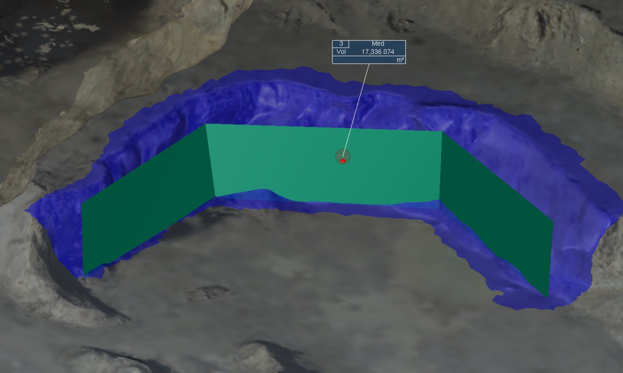
MEASUREMENT OF EXCAVATIONS AND QUARRYING
This time we will talk about the importance of knowing and quantifying the terrestrial morphology and its dimensions. There are situations or scenarios where the

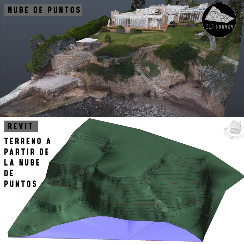
TOPOGRAPHY IN REVIT | TOPOGRAPHIC TERRAIN | MALLORCA
Today we want to talk to you about the Topographic Lands in Revit, more and more requested by the architecture offices, what they are looking